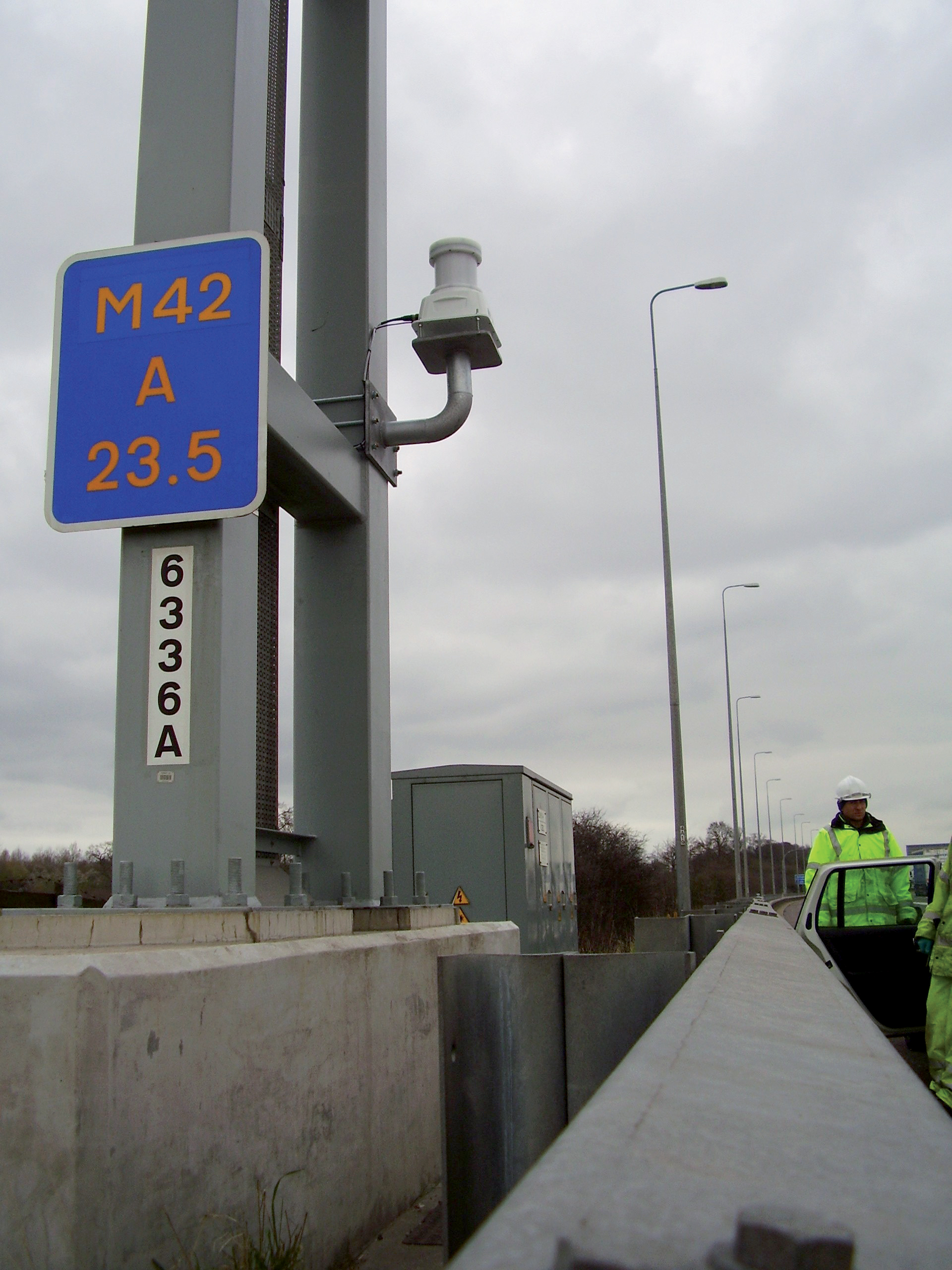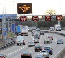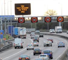
Navtech radar in use during the HASMOS research project
David Crawford detects a market for European experience
Well-established now in at least three European countries, Hard Shoulder Running (HSR) on motorways is exciting growing interest in the US. A November 2010 Report to Congress by the"The key difference with ATM systems is the way in which they integrate different strategies and technologies using real-time data. This results in more uniform traffic flow and safer driving conditions," says FHWA spokesperson Nancy Singer.
Specifically, the FHWA is being recommended to develop clearer guidance for state DOTs on the large-scale deployment of HSR. Singer told ITS International: "There are a number of design, safety and operational issues surrounding the use of highway safety shoulders for travel lanes.
"There is also a lack of information to support appropriate policies and guidance to states. The FHWA is undertaking additional research and analysis further to examine these issues."
Sweating the asset
With congestion in US urban areas remorselessly rising, the FHWA has designated mitigation as one of its top priorities. All its strategies centre round the theme of increasing the efficient use of existing capacity.One safety concern arises from the loss of a continuous emergency refuge area for disabled vehicles and during incidents. The solution involves purpose-built refuges at specified intervals, as in the Netherlands and UK (but not Germany), linked by phone and CCTV cameras to a control centre.
Another is the need for clear guidance for motorists entering the HSR and close monitoring of its operation. Stationary vehicles and pedestrians present the major risks.
Appropriate technology is an area in which European experience has a great deal to offer and US transportation officials have been paying regular inspection visits. A frequent destination is the UK's National Traffic Control Centre (NTCC) near Birmingham. Run by the
Its original HSR site, which went live in September 2006 on a 16km section of the M42 motorway south of Birmingham between junctions 3a and 7, is the birthplace of full-scale active traffic management in the UK. With
Obstacle checking
Checking that the HSR lane is clear of obstacles before opening is carried out by operators at the nearby NTCC checking feeds from 200 CCTV cameras positioned along the route. The HA has considered automating this process (see Sidebar, 'HASMOS') but has decided not to proceed at present. If an incident occurs, staff can close any individual lane or lanes by setting a red 'X' on signs over the lane(s) affected.Early results show more reliable journeys - HSR at 96km/h (60mph) delivered: an increase in journey time reliability of 27 per cent; reductions in emissions of up to 10 per cent due to the traffic flowing more smoothly; and, significantly, a decrease in personal injury accidents from an average of five to 1.8 per month.
The early success of the pilot site has persuaded the HA to carry out a wide-ranging review of its extensive planned motorway widening programme. A subsequent scheme has since become operational on 8.5km of the M6 from junction 4 to junction 5 northbound while another, between the M6 junction 10a and junction 18, is on programme to open in the first half of 2011. Both are in the Birmingham area.
Added refinements
The HA has also introduced a further refinement in the form of through running at junction 5 of the original scheme, which experiences some 90 per cent of drivers carrying straight on during the am and pm peaks. As a safety measure, it has equipped the VMS throughout the junction with revised software to enable their displays to change to indicate not only whether the hard shoulder is open to traffic but which lanes are available to exit from or stay on the motorway. The VMS also exemplify a move within the FA towards using pictographic rather textual content for signs, something which is likely to become increasingly evident across the English network.It also sees this dynamic use of VMS as a useful way of giving road users clear information on the layout of the road ahead, and what they can expect when travelling through or joining the M42.
The HA anticipates publishing a three-year safety report for the M42 junction 3a to junction 7 site, and a 'before' and 'after' monitoring and evaluation study of the M6 junction 4 to junction 5 site early in 2011.
The HA is sharing its experience at a European level with the Rijkswaterstaat (Dutch Ministry of Transport) and the Flemish (Belgian) Highway Authority through the ongoing PIM project.
US developments
US experience of HSR dates back to the 1970s but mostly in the transit sector, with the aim of speeding up bus services, the largest example being a 465km network in the Minneapolis-St Paul metropolitan region of Minnesota. Similar schemes operate in Canada and New Zealand.Virginia DOT's pioneering scheme allows all vehicles to use the hard shoulder during peak hours. It opened in 1992 on a 9.6km section of the I-66 between US Route 50 and Interstate 495 in Fairfax County.
The I-66, along with the I-95, is one of the two worst-congested routes in the US. The two roads run between the northern part of the state and Washington, DC. They handle roughly 196,000 and 267,000 vehicles per day, respectively, during peak periods.
The introduction of the I-66 scheme followed a decision by VDOT to dedicate the offside lane as a high-occupancy vehicle (HOV) feature, effectively squeezing the remaining traffic into what was left of the road surface. Originally installed as a temporary solution to increase capacity, the scheme has remained operational.
Its red X/green arrow directional signs are supplied by
A recent VDOT report concludes that the scheme offers "a cost-effective and efficient way to increase capacity", with a safety analysis suggesting no major adverse factors. To implement future enhancements successfully, however, it stresses the need for ITS applications including automatic incident detection, improved response and clearance programmes, and more effective dynamic message signs providing information to motorists to maximise the benefits.
HASMOS
HArd Shoulder MOnitoring System (HASMOS) was a research project sponsored by the HA and carried out by UK communications specialist Systems Engineering and Assessment (
Trialled on the M42 pilot site, it achieved a high detection rate for hard shoulder events but was not thought to deliver the level of performance required for deployment in an operational environment. Specific concerns were over misreporting loops and a high false alarm rate from the video analytics system.
The developers then identified, as a promising alternative, frequency-modulated continuous wave (FMCW) radar, which was installed at the site by
The effect was to raise alerts for the majority of the events that were detected by radar, while substantially reducing the incidence of false alarms.
The HA has since decided that HASMOS does not constitute an operational requirement. But the technology remains tested and available for potential future use.VDOT has now developed a real-time traffic information system to enable it to monitor conditions over the whole Fairfax County area. The system delivers speed, traffic volume, incident and congestion status in real time from loop detectors and displayed on maps based on a Google Map.
But, while DOT has discussed the issue of response management, it does not yet operate an automatic incident detection system. Most of the time, VDOT's Randy Dittberner told ITS International, manual incident monitoring by crews provides fast detection and response time. The DOT has not gone on to considered implementing HSR on the I-95 because of geometric design limitations.
Most other US states have so far been slow to follow the VDOT lead. North Carolina has considered HSR on both the I-77 and I-485.
On the former, it found that HSR could significantly reduce delays but the shoulder was not constructed to carry routine traffic loads. On the latter, preliminary investigation indicated feasibility but funding proved a problem.
Georgia DOT has enhanced shoulders on State Route (SR) 400 near Atlanta to carry transit buses when traffic in general-purpose lanes slows to 56km/h (35mph) or less, with clear signage for specially trained drivers. The new FHWA thrust will spark wider adoption and increased opportunities for ITS applications.


