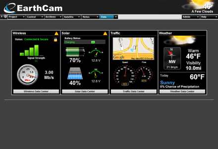
The software provides visually dynamic real-time views of essential solar and wireless system performance, current weather and forecasts. Technical details of wireless connectivity, solar power parameters, fuel cell data, camera location and other critical performance points are displayed simply in the data dashboard, a one-stop interactive graphic overview. Precise camera location mapping using 'on board' GPS and new Google Earth integration further enhances the new software.
A wireless data centre provides up-to-the-minute visuals tracing, connectivity, signal strength transmission rate and other relevant information for wireless systems, including 3G/4G cellular, Wi-Fi and microwave radio transmissions.
Other features include iPod, iPhone, iPad and other mobile device access, enhanced image comparison and a virtual construction x-ray.


