Transportation is dangerous, responsible for 30% of global cargo emissions today. Some experts believe that it will be responsible for 80% by 2050. And that’s before you even get on to the safety question - just ask tech entrepreneur Laura Schewel. “Transportation is getting worse while everything else is getting better,” she pointed out in a presentation last year. “Car crashes kill 1.3 million people each year and we know nothing about what is happening on the roads. Where are these people going? And how are they getting there? And why are they on the road in the first place?”
This is the conundrum that inspired Schewel to create the technology – via her work on geospatial Big Data for her PhD at UC Berkeley’s Energy and Resources Group - that underpins
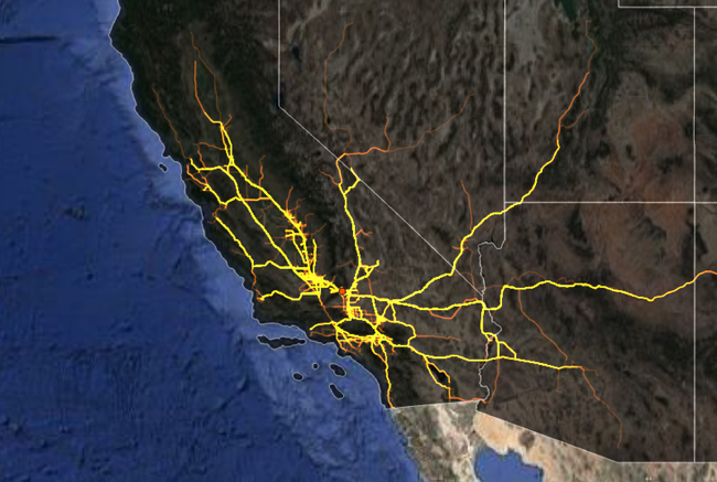
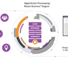
The company’s mission is to “analyse how people use cities and make it intuitive for anyone to explore and use that information” and to “enable safer, greener, and more productive businesses and cities”. Based in San Francisco, StreetLight Data (Schewel is founder and CEO) takes archival, anonymised and aggregated data from cellular towers and GPS navigation satellites and processes it with other more conventional types of data – which means the company can take a lot of information and turn it into a simple map.
“It’s relatively low cost and never follows the behaviour of an individual,” Schewel explains. Her idea is to make it straightforward for planners to incorporate transportation into all kinds of decisions about the economy: “We work with transportation engineers and city planners to help them make better models and measurements of what’s going on in cities so they can be more accurate in their plans.”
Educating stakeholders
Speaking to ITS International, Schewel made an important caveat to all this: “We can’t predict the future!” Not every company is quite so candid about what they can – and cannot – achieve, she suggests. “We need to educate high-level stakeholders like councillors and mayors not to fall for someone who says: ‘I can predict the future!’”
Her company is interested in the long term, she insists, and takes that attitude into negotiations with potential customers such as urban authorities. “We don’t dictate, we don’t tell them what to do,” she explains. “We’re much more interested in 30-year decisions. You need 30-year solutions.”
Building up a comprehensive evidence base is the starting point: if you want to find out the best place for bike lanes, then look at current traffic patterns. “Use Big Data to scan everywhere,” she says. “Look at everything.” In Virginia, the company looked at a year’s worth of data on one single project.
Political reality
But however much information you collect, it still has to be interpreted sensibly – and any solutions derived from it must take into account the fact that humans will have to implement them. In particular, the courses of action - preferably a choice of them - must be practical and acceptable to politicians, who will invariably be the ones allocating the money.
“I don’t think Big Data is a robot which says ‘do this’,” she muses. “But cities and transportation are always political: ‘Here’s 10 options. You’re going to choose three. But any one [of those] would be good’.”
Assessing people’s behaviour is crucial, she believes, and one obvious way of finding out how mobility works in practice is to run simulations. “Show me which factors are the most important for example, the availability of day care or schools – these come out on the list each time,” she explains.
But there is a flipside to this: doing the simulation is one thing – but establishing how accurate it has been is something else entirely. “In transportation we have a terrible history of measuring if what we predicted would happen actually happened – for example, re-zoning downtown. But with Big Data you can: you can build up a new database about how cities respond to changes. As always, something else like a new Uber [comes along] – and your plans go out of the window.
But behaviour is something we need to measure every day.” Cities need to understand what the key trends are in order to be able to respond to them with flexibility.
And this issue of measurement is crucial if trust in technology is to be maintained. “It matters,” says Schewel. “I’m starting to see a backlash in the private sector.” Her contention is that city authorities have been promised the moon and this has created a strain of ‘technology fatigue’. “You know: ‘we’ve spent all this money and I can’t even log in’. People have wasted money and time and that builds up resistance.”
Connected and autonomous vehicles (C/AV) is one such area where smoke and mirrors are sometimes felt to be in operation. “I see an extraordinary pressure on cities to become AV-ready,” she says. “But it’s totally unclear what this means. There is an over-emphasis on hardware: smart city investment needs a lot of flexibility.”
Painting lines
In other words, it’s not just going to be about spending a fortune on hardware embedded in the streets - in fact, she says, there is one pre-existing, ubiquitous, cheap technology which will still have great relevance in the years to come. “Paint is going to be the most important technology in the next 10 years! It allows you to make a bus lane, make a bike lane.” So, even in a brave new world of C/AVs, lines will still need to be painted, potholes will need to be filled in and leaves cleared from the highway.
The company has just added bike and pedestrian analytics to its existing StreetLight InSight platform – which means that the movements of vulnerable road users can be measured along with those of vehicles. It is an industry first, the firm insists, enabling planners to differentiate bikes and pedestrians from vehicular traffic, creating a digital dashboard of bicycle and pedestrian activity on roads, bike lanes, pavements and even parks.
This would allow planners to see what days and roads have the highest biking volume, at what time of day and for what reason, for example, and Schewel says: “My hope is that by being able to measure bikes and pedestrians, we can manage towards a future where these modes of travel are more prevalent.”
When it comes to the next big thing in transportation – well, that may be something outside of the sector’s control. “The economy is dominating the conversation,” Schewel says. “I see an increasing divide in the rural, suburban and urban experience - I haven’t owned a car in years because I’ve lived in downtown, urban areas.”
But the growth of ride-sharing is the source of a “coming, difficult conflict in the industry: in urban areas, how are we going to keep track of all those private taxi companies? What’s the city’s role in that?” Urban authorities are already struggling with this. And despite the best efforts of companies such as StreetLight Data, that struggle looks set to continue.


