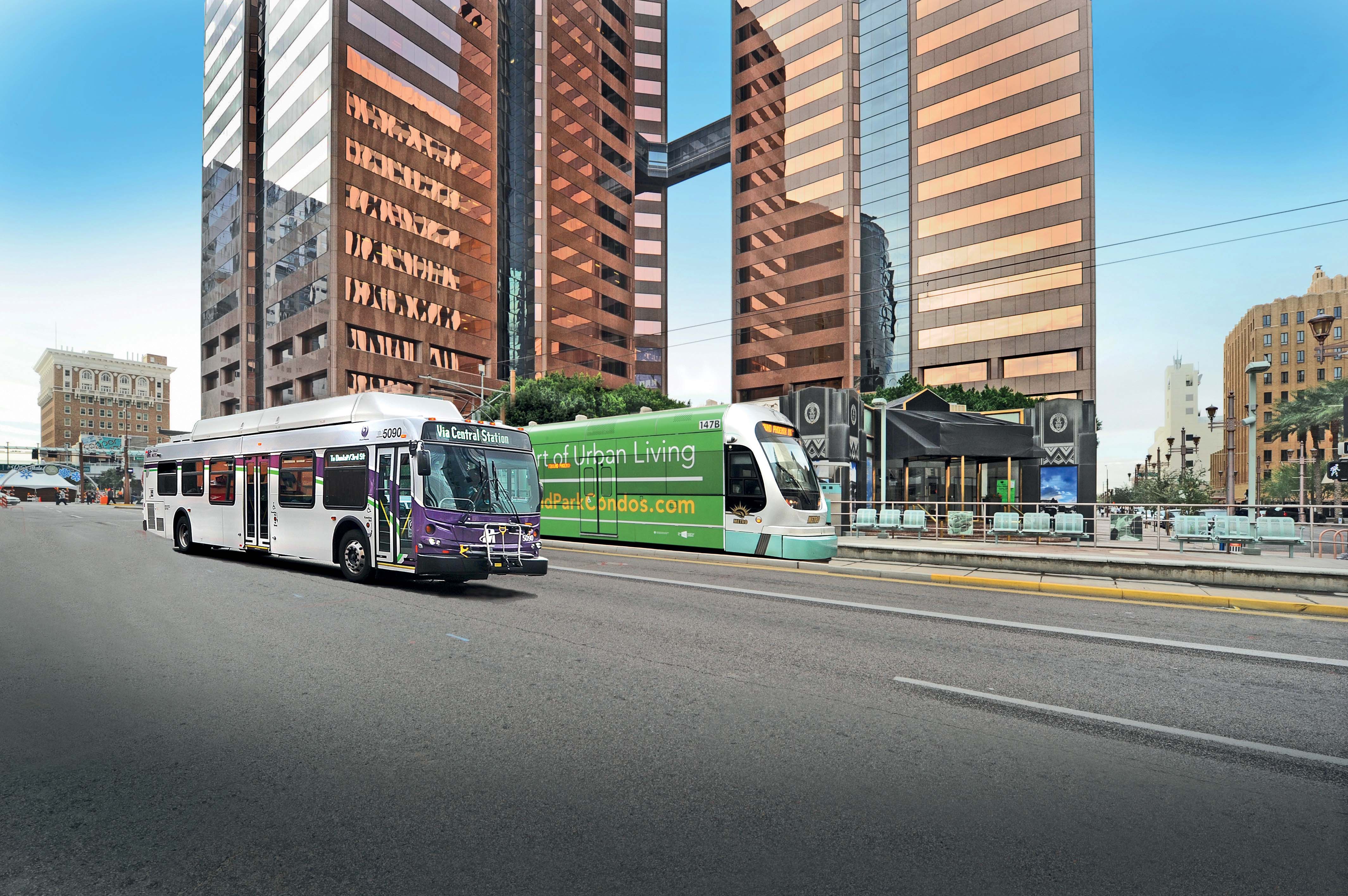
Andrew Bardin Williams looks at the City of Phoenix where voters backed a $30bn plan to revamp its transportation network to cultivate a more connected community.
According to a Land Use Institute study, half of all Americans and even more millennials (63%) would like to live in a place where they do not need to use a car very often. The City of Phoenix is putting in place plans to revamp its urban development and transportation policies to meet these changing quality of life perceptions.
Recognising that a new generation of residents wants to live in dense, urban neighbourhoods that are walkable, bikeable and have easy access to public transportation, Phoenix’s officials are focused on developing its inner core, downtown and Central Avenue areas. The hope and expectation is that educated, socially-conscious, upwardly mobile millennials will settle within city limits, attract businesses and contribute to the local tax base.
Planning for the Future
Like many other cities, Phoenix sprawled outward from a small, downtown core and as the population grew and people wanted more space, with surrounding dessert, farmland and pasture converted into vast housing developments with little regard for sustainability.
“We were a Twentieth Century city that needed to attract Twenty-First Century economic development,” says Alan Stephenson, director of planning and development for the City of Phoenix. “In order to be competitive we needed to create places where employers would want to locate.”
That change started in 2000 with a progressive general plan that focused on rebuilding the city’s downtown core around Central Avenue and continues with a 2015 general plan, which was ratified by voters in August. This seeks to create a ‘blueprint for a connected oasis’ and according to Stephenson a major component is the revamping Phoenix’s transportation network–including both surface transportation and public transit–to ensure the city is physically connected.
The first step is to foster transit-oriented development by supporting compact, small block, mixed-use development near planned or existing light rail stations and by continuing the development of Central Avenue as the city’s transit spine and main street. The plan also calls for public infrastructure design to include pedestrian and bicycle amenities to create a walkable environment and increase residents’ activity levels.
However, encouraging density in a city of 1.4 million people spread out over 519 square miles requires an enormous amount of public will. According to Stephenson, going against 50 years of development policies and fighting the perception of urbanisation were major concerns throughout the creation of the general plan and both the council and city managers knew that public buy-in was necessary.
Even before the general plan was approved its authors and department heads sought public input into the process through the formation of a citizen committee (to provide guidance) and more than 200 well-attended public forums. The plan was also put online and garnered more than 15,000 comments. When the general plan and the Transportation 2050 plan were put to ballot in August, they passed with 76% and 55% approval respectively.
Voters also passed a 0.7¢ tax increase on top of an existing 4¢ transportation tax to help fund the capital, operations and maintenance of the transportation improvements. The tax is estimated to generate $16.7bn with federal grants, state funds and the city’s general fund boosting the total transportation budget to $30bn (€27.4bn) over the plan’s 35 years.
The ballot measure will fund a variety of transportation projects including:
- Expansion of light rail and high-capacity transit
- Expanding bus service to unserved arterial streets
- Extension of bus service hours and erecting shelters at all bus stops
- Repaving every surface road in the city
- Enhancing traffic operations centres
- Increasing accessibility for the disabled (ADA) and adding new sidewalks and bike lanes
- Providing Wi-Fi on buses and light rail cars
- Implementing real-time data for trip planning and reloadable transit fare cards
Phoenix’s grid system was developed for the automobile and is being repurposed to support other transportation modes including public transit, bicycles and pedestrians. The plan embraces Complete Streets philosophies, aimed to develop and implement ‘policies and professional practices that ensure streets are safe for people of all ages and abilities, balance the needs of different modes, and support local land uses, economies, cultures, and natural environments.’
Every surface road in the city (totalling 4,856 miles) will be repaved and repurposed with these principles in mind while sidewalks and bike lanes will be added, connecting housing with retail development and transit stops. New land use policies will encourage new developments to locate parking to the rear of sites to create a pedestrian-friendly environment, and include amenities for transit, pedestrians and cyclists - to include LED lighting, wider sidewalks, bike racks and wayfinding.
ITS for public transit
In addition to expanding service and extending hours, the city’s public transit infrastructure will undergo a major overhaul to make the system more efficient, reliable, frequent and comprehensive. The goal is to continue to increase ridership (currently 45 million trips/yr on the light rail and bus systems), providing relief to the local streets and freeway systems. Multimodal transportation is a large focus, allowing for the safe and efficient movement of people while connecting the city’s activity centres, employment areas and neighbourhoods.
The goal is for 70% of housing units to be within one-quarter mile of a transit stop and 90% within one-half mile. This will require new land use policies (outlined in the plan) that further the urban village model with transit developments in appropriate city cores, centres and corridors. It also requires the level of walking and biking connectivity outlined in the Complete Streets section.
It also means a major expansion with a 300% increase in light rail miles and extends bus service hours.
ITS technology will play a major role with a new Bus Rapid Transit (BRT) system in the planning stages and the first route (Thomas Road) should be implemented within five years to alleviate roads that are already exceeding capacity.
The city’s bus and train fleets will be getting new CAD/AVL systems that provides free Wi-Fi to passengers and collects data, feeding it into a central traffic management centre. Beyond the vehicle’s location, the units will stream security footage, ridership information, traffic data and details of the vehicle’s health to engineers who can remotely change traffic signals, add or subtract vehicles and make other decisions on the fly.
According to Hyatt, her department is working with traffic engineering agency CH2M to develop reloadable fare cards and mobile ticketing systems which will be phased in over the next five years. The team is reviewing comparable systems in other cities to determine what is working and how best practices can be implemented in Phoenix. Real-time transit information and digital signage are other projects slated in the next few years.
The plan also calls for a greater emphasis on creating bikeable neighbourhoods to connect the city’s bike infrastructure in a single system, joining up disparate parts of the city and tying bike usage to public transit. Physical barriers that inhibit bike use will be deconstructed and grade-separated crossings of freeways and arterials will be considered with a 2020 goal of increasing the length of bicycle lanes by 20% and lockers by 25%.
Becoming a Smart City
Tying these transportation projects together in a cohesive plan with stated goals required a new level of analytics so the city launched a Big Data project to integrate the volume of data each department generates. Based on an
For example, fire and emergency services could access real-time traffic information from the Streets Department to map out the fastest routes to an emergency, and Public Works could leverage the human resources database to track trucks and employees on their maintenance schedules.
The Oracle BI solution builds on Phoenix’s existing
Transparency and Measurement
A long-term capital improvement plan includes an annual check-up across all agencies to see how the city is doing–a large part of which is the ability to analyse data collected by the various city departments. Recommendations arising from the findings are sent to city managers who can tweak planning and development policies to meet the dynamic needs.
The general plan calls for the creation of a Citizens Transportation Commission appointed by the mayor to advise the council and city managers on the residents’ needs. The commission has oversight of the $30bn transportation budget and the power to periodically review the plan and make recommendations to ensure goals are being met.
“We need public participation throughout the process to make this work,” Stephenson says.
What he calls a “transparency website” will be launched in January, showing progress (such as how many miles of bike lanes have been added or how many buses have been outfitted with public Wi-Fi) towards the goals outlined in the general and transportation plans. Each department is responsible for updating the public on the progress of its projects throughout the life of the general plan.
In the meantime, Phoenix will continue to move forward on the planning and development stages for transforming the city. Policy changes are being studied and discussed with residents and nearly 1.5 million people are relearning how to move about each other safely, efficiently and with respect to one another.


