An air quality evaluation system that utilises existing data has been modelled on the UK’s motorways and tested in Manchester as Peter Kirby and Paul Grayston describe.
It has long been known that emissions from road transport are the principal source of NO2 pollution, especially in the urban environment, and that appropriate transport management can play a big role in meeting environment and public health objectives. What is less clear is what form that management should take – banning trucks or all vehicles, implementing low emission zones or encouraging low emission vehicles.
However, this is not the case on motorways where there is a notable absence of proactive traffic control measures to reduce emissions. While some motorway projects have shown environmental benefits, these are largely fortunate side effects of schemes to increase capacity or improve journey time reliability.
As part of a small innovation study in 2014/5,
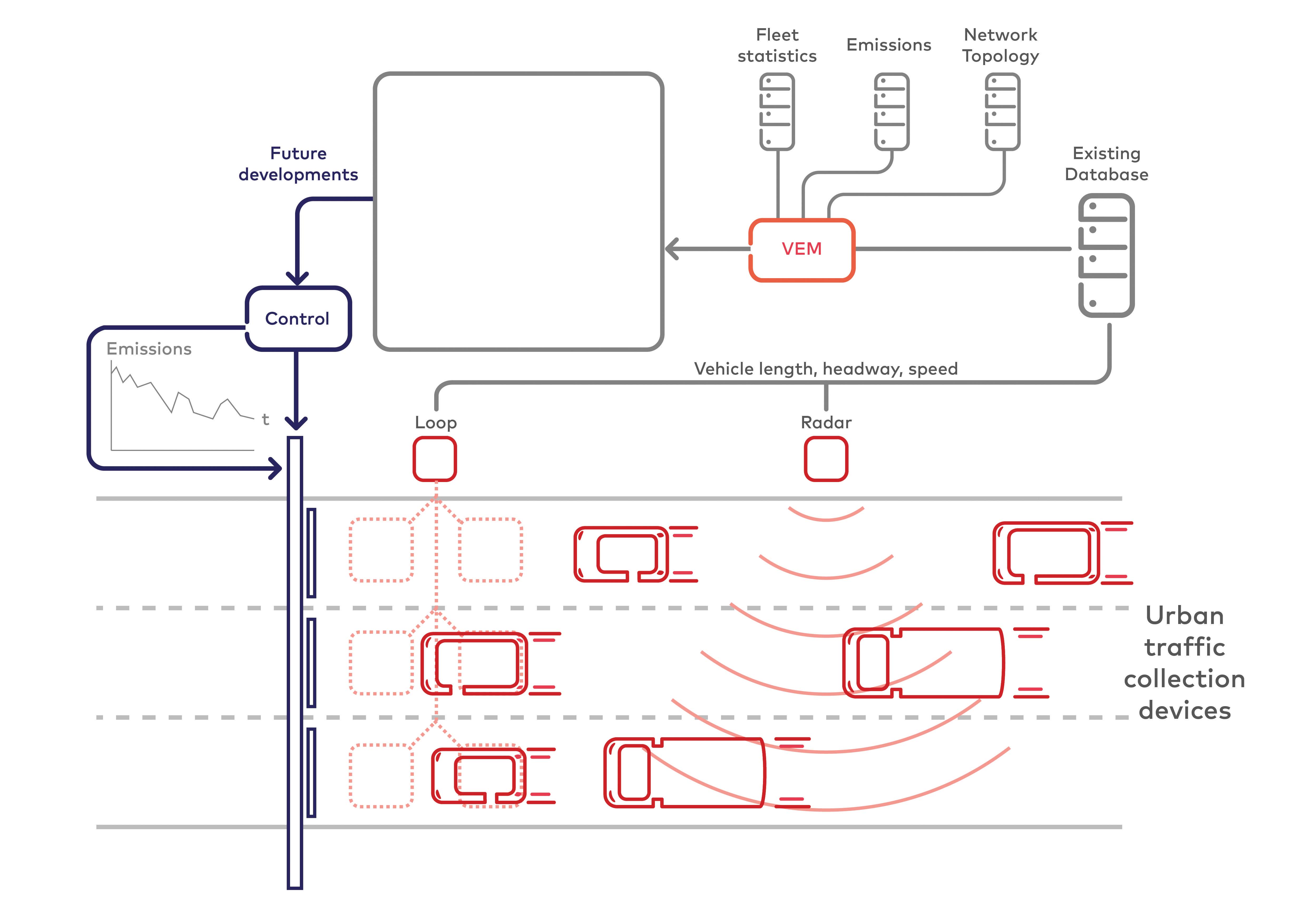
The AEC coupled official fleet projections (the proportion of vehicle by categories, fuel types…), of emission profiles by vehicle model and speed with simulated real-time traffic data collected from virtual inductive loops in the traffic model, to calculate emissions within the motorway corridor.
In this case the AEC prototype was a dynamic corridor-wide control system which catered for network topography, gradients and recurrent congestion on the southbound M1 near Sheffield.
The AEC determined the emissions profile every 500m throughout a 9km (5.7mile) model and assessed in real-time the occupancy within the modelled network using traditional methods. If the real-time emissions profile exceeded the threshold at any location, control mechanisms such as mandatory speed restrictions, lane closures or vehicle-type bans were implemented to reduce vehicle emissions at that location.
By taking a corridor-wide approach, the AEC showed that it is possible to reduce vehicle emissions by more than 20% at sensitive locations within the motorway network. While this is a clear achievement, analysis of the overall modelled network showed a 1.7% increase in the total volume of emissions generated – particularly upstream of the targeted area. Although this sounds negative, the system could benefit the likes of air quality management area currently exceeding the EU limits by effectively moving the emissions to locations of less concern.
While the AEC employed non-standard control techniques such as dynamic, lane-specific vehicle-type bans, the project indicated that emissions from vehicles within the motorway network can be reduced using traffic control techniques. It also brought with it a modest overall improvement in journey times within the model.
Wider application
Following completion of the AEC project, Dynniq began the development of the Virtual Emissions Monitor (VEM). This was based on the initial AEC concept of estimating real-time emission profiles using datasets generated by the National Atmospheric Emissions Inventory (NAEI), real-time traffic speed, flow and vehicle classification. The VEM was applied to
The VEM was subsequently improved to accommodate network and fleet filters to show the emissions on the M60, or emissions generated by particular vehicle type and/or Euro classification.
This was followed by interfacing to Highways England’s central systems for real-time functionality, enabling operators to understand the current emission profiles throughout the network. At Intertraffic the company demonstrated to an international audience the VEM’s advanced user-interface for area-specific monitoring, historic data analysis functions and a ‘what if’ scenario management tool.
By using the existing infrastructure and datasets, the VEM provides a cost-effective tool for network managers while the map/dashboard presentation provides detailed insight to the specific contributors to network emissions. This allows network managers to understand the effects from HGVs or a particular Euro classification of diesel cars - knowledge that can inform traffic control interventions and help shape transport policy.
As the system calculates tailpipe emissions, its output is not influenced by variable factors such as wind speeds, surrounding buildings or road layouts and can therefore enable like-for-like comparisons of the effects of traffic changes.
Urban areas
Dynniq was able to move the VEM into the urban environment when it partnered with Transport for Greater Manchester (TfGM), the University of Manchester and transport and environment specialist KAM Futures on a real-time urban air quality analysis, information and actuation solution named Aquaria.
This prototype system uses emissions profiles generated by the VEM (through the processing of real-time traffic data) in conjunction with wind speed measurements and dispersion modelling to predict and spatially visualise real-time estimates for NO2 concentrations within urban environments.
Part of the project involved an assessment of the conditions under which implementing of a targeted traffic control plan could avoid or shorten an NO2 concentration exceedance. Analysis of historic data (1 June 2014 to 29 Feb 2016) from Manchester University’s Whitworth Observatory was undertaken to determine incidents when the 95th percentile of measured NO2 exceeded 59.2µg m3. These were found to be highest in the autumn and winter, with the wind speed below 2.5m/sec and in the morning peak during school terms.
In order to test the emissions altering hypothesis and attempt to reduce the NO2 concentrations, a traffic control plan was implemented in TfGM’s SCOOT system for the morning peak over a three-day period towards the end of the three-month project in March 2016.
An experimental traffic control plan was implemented by making changes to the SCOOT model to prioritise a main arterial route into Manchester at the expense of the side roads. The system predicted air quality using the VEM to capture the changes in traffic behaviours and the NO2 dispersion model.
Data including live spot vehicle classification, speed and vehicle flow from automatic traffic count (ATC) sites was used to generate the representative urban traffic profiles in combination with traffic volumes reported by the SCOOT system. Link journey times and a combination of live Google journey time predictions and Bluetooth data were used to infer speed.
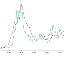
These inputs enabled the NO2 concentrations to be estimated using an urban dispersion model specific to Manchester and the estimations were cross checked using actual NO2 measurements acquired using a NOx analyser located within the study area. The NO2 predicted by the VEM’s traffic data and dispersion modelling was compared with actual measured NO2 and the modelled vs measured results for the Manchester study area plotted for one 24 hour period (25 January 2016). These are only indicative due to the limited time period but show a good correlation – indeed the two profiles achieve a coefficient of determination (R2) of 0.66 which is comparable with the accuracy of existing air quality models.
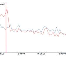
The VEM evaluation indicated that the effect of altering the traffic control plan generated a reduction in tailpipe emissions of between nine and 17% (see graph). Using a fixed 2.5m/sec wind speed in the dispersion model (to compare with/without traffic control scenarios), the modelled NO2 concentrations were reduced by between 2.9 – 4.9µg m3 in the morning peaks over the three-day period. The company is now investigating how the potential effects on air quality of the traffic control plan on the wider area can be represented.
While the reduction in NO2 concentrations are favourable the results can only be indicative due to the fixed wind speed and limited dataset mean. But what they do show is that the traffic data inputs and calculations used by the VEM have recognised the change resulting from the implementation of the traffic control plan. This provides confidence that the system can be used to assess a wider range of interventions.
The AEC project confirmed that traffic control techniques in the inter-urban environment can be utilised to reduce emissions at sensitive locations and the VEM tool has the potential to help local and national authorities manage air quality.
From an urban perspective, it demonstrated that bans and curfews are not the only way to improve air quality in sensitive areas. It showed that existing real-time traffic data and dispersion modelling can be used to predict NO2 concentrations within urban traffic networks as accurately as the existing air quality models used by many local authorities. Furthermore, VEM can be used to assess the effects of a range of interventions without the need to deploy air quality monitoring devices.
The validation of the modelling approach indicates that the VEM can help road network managers to devise temporary traffic control intervention plans and decide when and where to deploy these to mitigate the overall effect of vehicle emissions.
However, further implementations on other corridors and wider geographic areas are recommended along with the collection and validation of data over a full 12-month period.
| Day | NO2 Concentrations (ug m3) with TCP | NO2 Concentrations (ug m3) without TCP | Difference between averages (ug m3) | Percentage change | ||
| Sum | 5-minute average | Sum | 5-minute average | | ||||
| Wednesday | 318.1 | 28.9 | 366.5 | 33.3 | -4.4 | -13 | ||
| Thursday | 314.6 | 28.6 | 346.2 | 31.5 | -2.9 | -9 | ||
| Friday | 269.7 | 24.5 | 323.7 | 29.4 | -4.9 | -17 |
Air quality limits
European Directives on Ambient Air Quality stipulate limits for the concentration levels of nitrogen dioxide (NO2) within road networks to protect public health. The regulations set an upper limit of 200µg m3 which is not to be exceeded more than 18 times a calendar year and an annual hourly average limit of 40μg m3. Official UK forecasts are that the majority of the UK’s air quality reporting zones will still be non-compliant for NO2 by the 2020 target date.
- ABOUT THE AUTHORS: Peter Kirby and Paul Grayston work for Dynniq UK as principal consultant and senior solutions manager respectively.


