While it is well known that the fatality rate for road crashes in rural areas is higher than in towns and cities, some groups suffer far more than others. For instance, the rates of death and serious injury from vehicle accidents is much higher for American Indian and Alaska Native (AI and AN) populations living in rural tribal lands than for any of the country’s other ethnic populations. Crashes are the main cause of death for AI and AN travellers aged up to 44 and they also have the highest alcohol-related crash death rates of any racial group in the US.
The US government officially recognises over 500 Indian tribes in the contiguous 48 states and Alaska as ‘domestic dependent nations with internal self-government’. Tribal lands have a total area of 227,000km2 (about the size of Idaho) but fewer than half the AI population live on these lands and many others reside in similarly rural areas. Some 25% speak a language other than English at home.
Both US federal agencies and tribal transportation leaders agree that road safety in the tribal areas needs urgent attention but there is a lack of research to support appropriate policymaking and investment decisions.
In Minnesota, the incidents of traffic deaths among the AI and AN population is 2.5 times higher than the general population and a recent tribal road safety summit in the state highlighted the need for accurate geographical data on accident types and locations. Many incidents occur on dirt roads that are well below normal US standards of construction and maintenance.
Professor Kathy Quick, of the Roadway Safety Institute at the University of Minnesota, says “much existing research is at the level of the AI population in the US as a whole. That does not give us a very good picture of what is happening in particular locations.”
Accordingly, the Institute has started a project, in partnership with specialist software developer
GIS technology has been in use in the US’ Indian territories since 1985 in programmes for recording and supporting land claims and for managing tribal property and heritage assets. Bills notes that there are some “outstanding technical capabilities within tribes.”
One AI entrepreneur, Jonh Goes In Center, a member of the Oglala Lakota Nation and founder of Innovative GIS Solutions, says: “Native people are spatial reasoners, and the adoption of new tools and the use of digital data are the only differences from yesteryear.” The project aims to reduce road crashes by focussing on such qualities and using analytical tools to inform decisions.
It is developing a set of GIS-based road traffic applications for tribal use using sample safety data and inviting structured feedback on their perceived value. The exercise will include the relative value of the data in, for example, accident hotspot analysis and the availability of user-friendly methods of digitally charting safety trends and conditions. The outcome will reinforce both the quality of accident data and its effective communication to relevant external US state jurisdictions and agencies as well as encouraging the sharing of experiences and best practice between tribes using a dedicated AI GIS data platform.
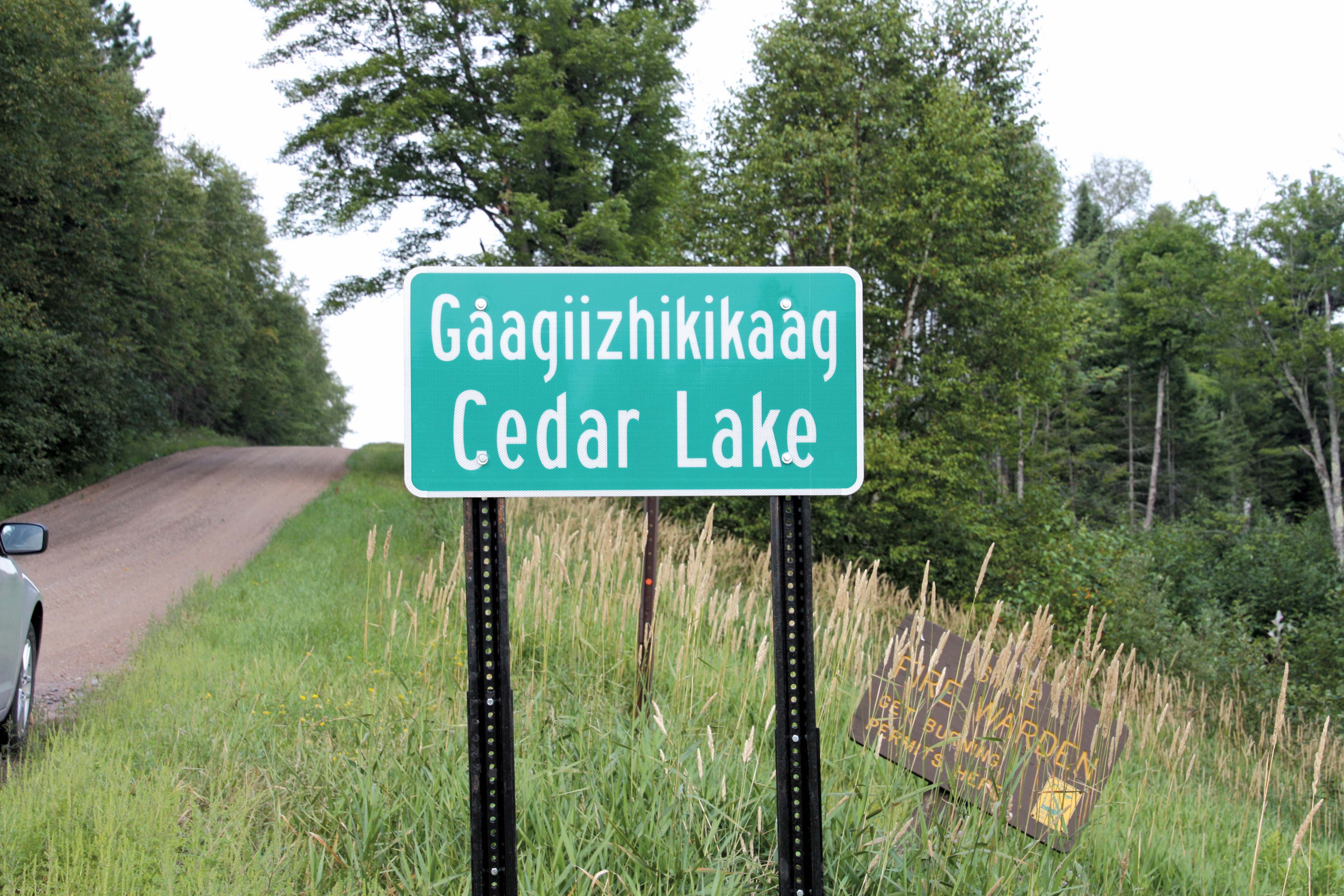
Conveying the messages emerging from the research - to road users from inside and outside the tribal communities - needs effective communication including conventional static and electronic signs. The former have dual roles - specifically as carriers of safety warnings but also, more subtly, as cultural markers, in encouraging outsiders to be aware that they are entering a different territory with its own norms and customs. Communication brings up the issue of language, an area where cultural guardians of ancestral tongues from around the world have some decided views. In Minnesota, the indigenous communities recently won a landmark battle with the Federal Highway Administration (FHWA) over the use of bilingual boundary markers.
Following a widespread global convention, the tribes wanted their local place names to be above the English versions and in an equal type size. But the FHWA disagreed until the Minnesota Advocacy Council for Tribal Transportation cited the FHWA’s own Tribal Consultation Plan to win the day.
Jason Hollinday, the director of planning at the Fond du Lac Reservation, which is working closely with the Road Safety Institute, told ITS International: “Our plans are for dual-language signs for place names or geographical features. We are not moving towards regulatory signs at this time, and have not yet discussed a long-term strategy for electronic signs and internet use.”
When these stages arrive, however, there will be some practical issues to resolve as AI languages do not currently enjoy a single uniform orthography for translation into English and AI words can be considerably longer than their English equivalents
Under-researched
In a February 2016 webinar, Professor Quick identified two specific under-researched tribal issues: pedestrian safety and driving while under the influence of alcohol. The former reflects the fact that large numbers of tribespeople habitually walk long distances - along roads that are often inadequate. This can present unexpected hazards for drivers coming in from outside (tourists are an important element in tribal economies).The Fond du Lac Band is actively encouraging the walking tradition (in the interests of members’ wellbeing) but Hollinday highlights a lack of safe paths and sidewalks along or near local roads.
Another problem is the high proportion of younger AI people that do not have a car or driving licence. And while a reservation like Fond du Lac may have its own transit network, with only eight vehicles the schedules are not always flexible enough to meet many potential users’ needs.
Therefore the Institute sees a need to develop systems to alert arriving motorists and is currently working with four tribal governments, including that of Fond du Lac, on a targeted safety campaign to encourage slower and more careful driving.
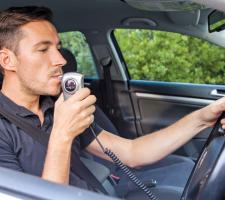
The concern about driving while under the influence emerges from an apparent failing among all tribal stakeholders to take the matter seriously enough. This leads Quick to suspect a ‘nervous area of government’, which discourages debate and the closer investigation of appropriate responses and warning systems.
However, the US Centers for Disease Control and Prevention, whose remit covers vehicle safety, tackles the issue head-on in a ‘toolkit for tribal populations’ which recommends, for example, that their governments should fully enforce existing laws, designed to prevent drinking and driving, with zero tolerance for younger drivers, and require an automatic ignition interlock in the vehicles of those convicted of the offence.
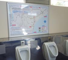
Included are reminders that, unlike the home countries of many of its visitors, New Zealand drives on the left. The maps contain QR codes, for scanning by smartphone users to open the South Canterbury Road Safety website which itself contains foreign-language sections.
NZ rural roads are typically narrow and overtaking can be hazardous. Daniel Naudé, road safety coordinator for Timaru, the urban hub of the region, says tourists are especially vulnerable if they think routes are going to be “quick and easy”.
He came up with the idea after realising that, while it can be difficult to get people to stop and take in road safety information, putting the message in lavatories could make for good reading "for 30 seconds when there's nothing to do".
He told ITS International: “I downloaded the data from our national crash analysis sys-tem, then our GIS team added the 3-D effect and the legend items.”
The idea has already been taken up by other NZ districts and Naudé has had en-quiries from the US and UK.


